
I’m always looking for new walks, especially riverside ones, but I never expected to find one in the middle of Yeovil. I was idly looking online for the source of the River Yeo, after which the town is named, and came across a reference to Dodham Brook. Intrigued, I dug deeper, and discovered that in fact Dodham Brook is one of the old tributaries of the Yeo, and far from having been consigned to a pipe like many lost urban streams, still spends much of its three mile journey above ground. This had to be investigated!
As I suspected, the old stream doesn’t have glamorous beginnings, emerging from a pipe at the top of Larkhill Road, although from looking at the 1898 map, it obviously originally began over the road under what is now Wessex Road.

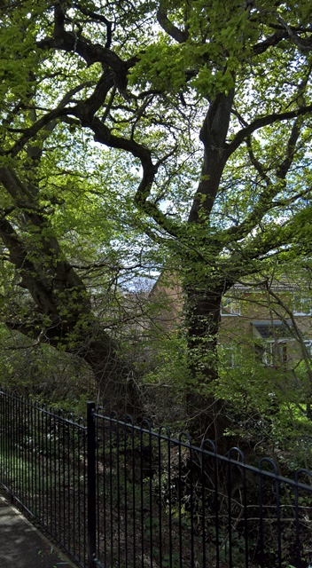
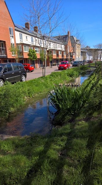
But things began to look up almost straight away – I soon realised that this was a well-known and well-kept footpath (someone from the Council had just been strimming along the back of Guinevere Close, as you can see below) and not a ‘hidden stream’ in the slightest. Obviously I had just never heard of it.

OK, so we’re not exactly talking the source of the Nile here, obviously, and, as you’d expect, it’s not completely rubbish free…

But it’s obviously survived anything Yeovil can throw at it – these trees are very much older than the Tintagel Road houses behind them (yes, this area of Yeovil has a bit of an Arthurian theme happening with the street names).
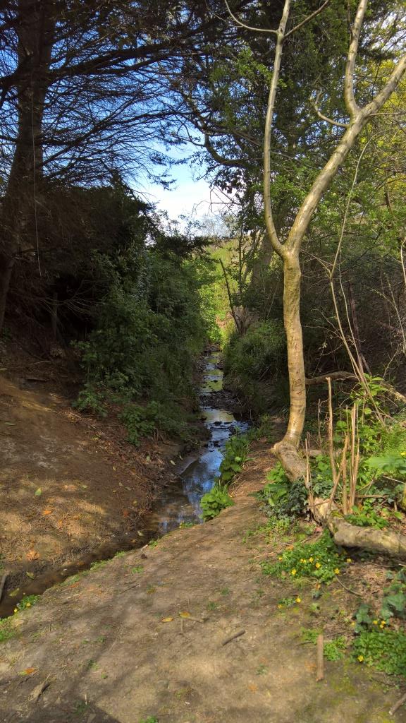
But very soon, you leave the houses behind, and for a little while, you could almost believe you weren’t in the town at all…

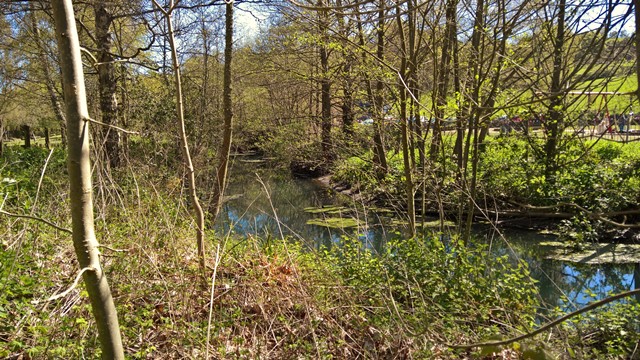
…and the brook becomes almost pretty…
But then you start getting back into civilisation – alongside Brook Close, in fact…

Now we’re getting closer to town, and for the first time the Brook heads underground as we reach the Glastonbury Court sub-station (told you).

But very shortly the Brook re-emerges, and, for just a moment, you could almost be walking in a French village, and not the back of Shelley Close…

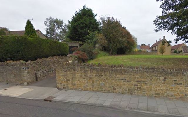
The path carries on behind the Stourton Way estate for a little while, and then suddenly stops when you get to the Preston School playing fields, which are just the other side of this hedge.

So, for a little while, there’s no choice but to hit the pavements of White Mead…
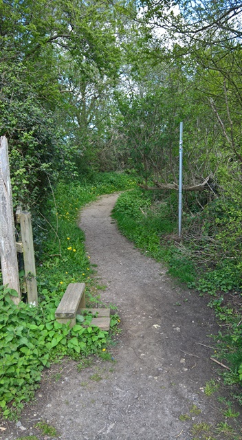
But very soon you pick up the ‘footpath’ again…

…before finding a proper footpath that takes you along the southern edge of the playing fields.
This winds around the back of St James’s Close, before emerging here, on Preston Road…
…right next to one of Yeovil’s oldest buildings, the 15th century tithe barn at the centre of the what is now Abbey Manor Business Centre. Until relatively recently, most of this was fields, until the Bartlett Construction company bought Abbey Farm, as it’s commonly known – it was originally known as Preston Great Farm – and now there’s a lot more Yeovil than there used to be (or should be, as some would say).

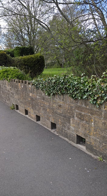
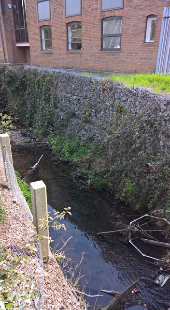
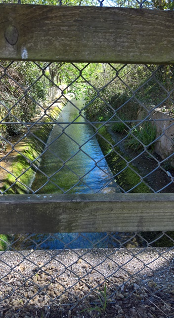
The Brook is now culverted under the road, as these holes in the wall above it testify…
The Brook then resurfaces at the other side of the road, alongside Bell Chase…

…and heads along the end of the Bell Inn’s car park. No, I didn’t stop in for a quick one. Next time…
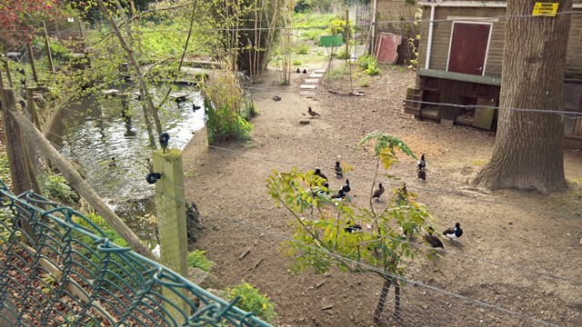
Now the Brook heads off towards the (relatively) new Century Park housing development. Yes, that is a pair of Mallard.

Now, you can either walk along the road at this point, or the completely unmarked footpath to the right of the Brook.


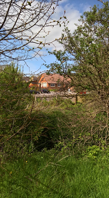
It’s probably unmarked for the same reason it’s fenced off to one side – you’re now going along the northern edge of Westland’s airfield. It starts to get a lot less scenic now (we’re now at the back of Dodham Crescent).

The path carries on past the various Westland’s facilities, sports grounds etc, before finally coming to an abrupt halt at West Street.
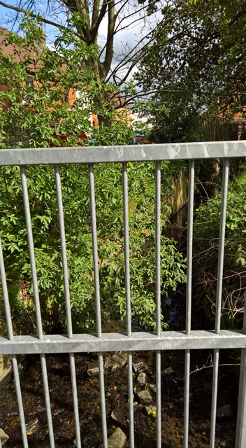
After this, the Brook carries on southwards, between the back gardens of West Street and Seaton Road, but unless you’re wearing wellies and want to climb over the bars, that’s as far as you can walk alongside it – for now.

Now you have a little walk down either Seaton Road or Beer Street, heading for the Brook’s next appearance, on West Hendford. Hey, I never said this was all glamour. But before you head south, just head north for a moment on West Street, because there’s a little surprise waiting for you…
Yes, that’s a back garden full of Tufted Ducks. Absolutely no idea why.
So anyway, turn around, and head for West Hendford, where you’ll find this glorious view. But look closely – that blob sat on the wall, against the yellow T shirt, is actually a Grey Wagtail. There was a pair of them flitting about in the Brook. Even in the grimmest of places…

So, south again, but again, we can’t follow…

Now you’ve got another short walk down Horsey Lane, until you get to the Police Station. On your right, our friend briefly becomes visible again…

…before disappearing under Lysander Way, re-emerging briefly alongside Bradfords Building Supplies, then under Hendford Hill…
…and back out for its final journey, along the back of the Cooper’s Mill pub (no, didn’t stop for one there, either)…

…Goldenstones Leisure Centre (in the background)…
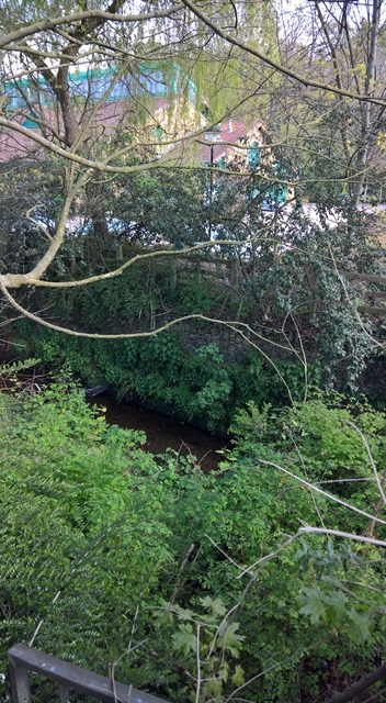
…and towards Ninesprings Country Park, one of the jewels of Yeovil, where things start to get a whole lot prettier.

But not for long – after you pass the playground (in the background), Dodham Brook is in concrete again, where it stays until gets past the Cineworld complex.

It briefly gets pretty again as it passes the new Glove Factory development…
But it doesn’t last long…
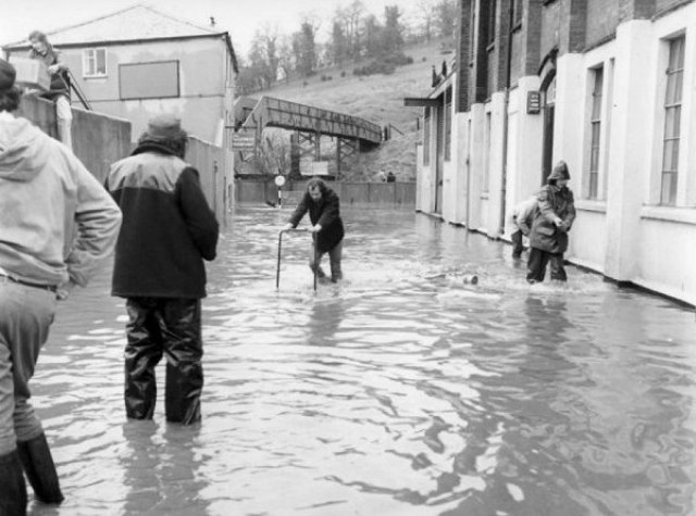
To be fair, this was done in the 60s to stop it flooding, which it used to do a lot, as can be seen from the photo below. The building on the right is the old Glove Factory, now townhouses and apartments, while the bridge in the background crossed Dodham Brook from Summerhouse Hill. This is where the Cineworld complex is now, but at the time of this photo was the site of the old Town Station. This photo came from Bob Osborn’s wonderful A-Z of Yeovil History, which, if you’re at all interested in the town’s past, I highly advise visiting.
Once past the Cineworld complex, it disappears again, briefly, as it winds through the Newton Surmaville estate…

Now you’re in another part of Yeovil Country Park, the Railway Walk, which as you can imagine follows the path of the old railway, and which eventually brings you out above Pen Mill Station. But before you get there, you finally get to the end of Dodham Brook’s journey, as it joins the River Yeo.

A shallow ‘beach’ at the junction of Brook and River, from which Woody, naturally, waded in.

So there you go, a little bit of our town that makes it just a little less ordinary than many think it is. Now all you have to do is walk back to Wessex Road, where you left your car. Or get the number 11 bus. Actually no, as it happens, I didn’t, I walked. This not smoking thing does wonders for the fitness.

3 thoughts on “In search of Dodham Brook”